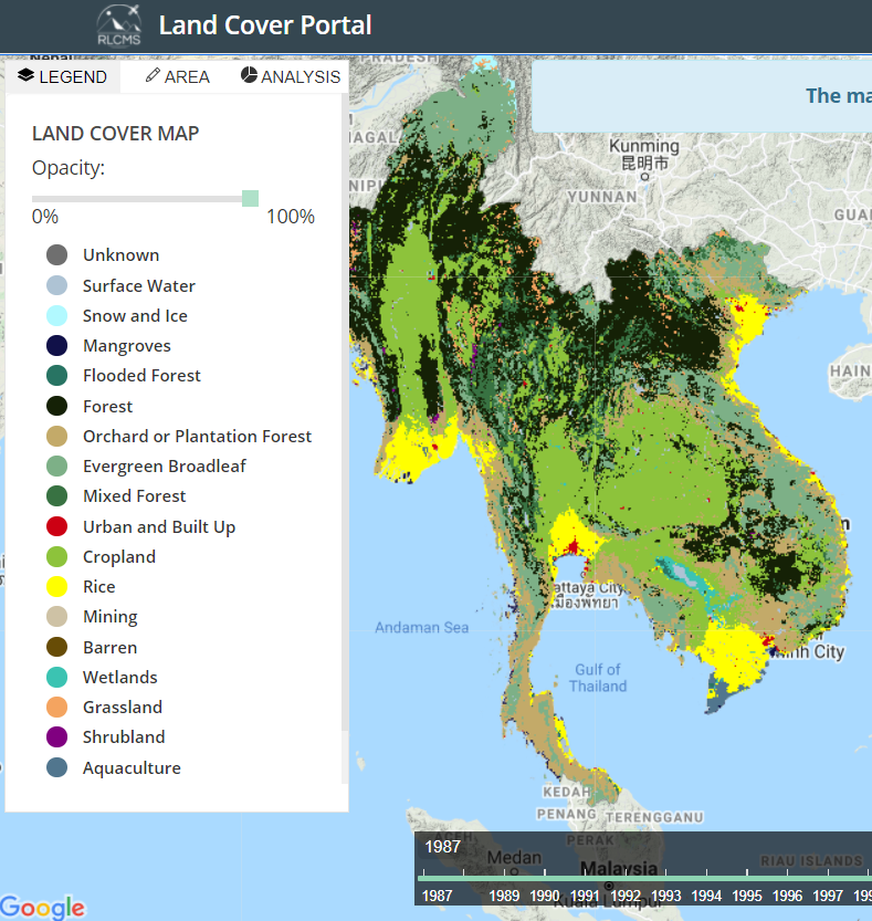
This interactive map shows land cover change across the Mekong region over time. The system utilizes satellite technology to facilitate the production of customized, high-quality regional land cover maps at a 30-m resolution for each year from 2000 to present, in addition to complimentary land cover information. In addition to the interactive web map, the underlying data can be downloaded.