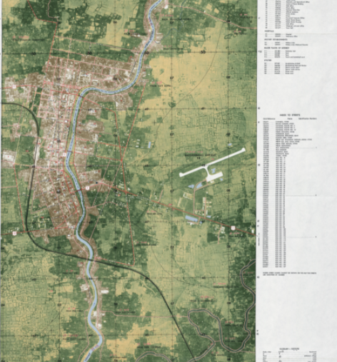
This map, created by the United States Government and released in 1971, provides a detailed representation of roads, key landmarks and building, administrative boundaries, and ecological features in Battambang. The map can be zoomed in for greater detail. [original scale 1:12,500, Edition 1-TPC, Series L9010. U.S. Army Topographic Command, 1971]
User notes: Map made available by the University of Texas at Austin Libraries.